
Brazil
Fast Facts
Official Name: Federal Republic of Brazil
Form of Government: Democratic federal republic
Capital: Brasilia
Population: 183,888,841
Official Language: Portuguese
Money: Real
Area: 3,286,470 square miles (8,511,965 square kilometers)
Major Mountain Ranges: Serra do Mar, Serra do Espinhaço
Major Rivers: Amazon, São Francisco, Paraná, Tocantins
What You Should Know
Following more than three centuries under Portuguese rule, Brazil gained its independence in 1822, maintaining a monarchical system of government until the abolition of slavery in 1888 and the subsequent proclamation of a republic by the military in 1889. Brazilian coffee exporters politically dominated the country until populist leader Getulio VARGAS rose to power in 1930. By far the largest and most populous country in South America, Brazil underwent more than a half century of populist and military government until 1985, when the military regime peacefully ceded power to civilian rulers. Brazil continues to pursue industrial and agricultural growth and development of its interior. Having successfully weathered a period of global financial difficulty in the late 20th century, Brazil was seen as one of the world’s strongest emerging markets and a contributor to global growth. The awarding of the 2014 FIFA World Cup and 2016 Summer Olympic Games, the first ever to be held in South America, was seen as symbolic of the country’s rise. However, since about 2013, Brazil has been plagued by a shrinking economy, growing unemployment, and rising inflation. Political scandal resulted in the impeachment of President Dilma ROUSSEFF in May 2016, a conviction that was upheld by the Senate in August 2016; her vice president, Michel TEMER, will serve as president until 2018, completing her second term.
Geography
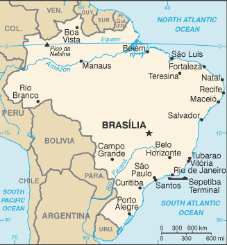
Brazil is the largest country in South America and the fifth largest nation in the world. It forms an enormous triangle on the eastern side of the continent with a 4,500-mile (7,400-kilometer) coastline along the Atlantic Ocean. It has borders with every South American country except Chile and Ecuador.
The Brazilian landscape is very varied. It is most well known for its dense forests, including the Amazon, the world's largest jungle, in the north. But there are also dry grasslands (called pampas), rugged hills, pine forests, sprawling wetlands, immense plateaus, and a long coastal plain.
Northern Brazil is dominated by the Amazon River and the jungles that surround it. The Amazon is not one river but a network of many hundreds of waterways. Its total length stretches 4,250 miles (6,840 kilometers), making it the longest river on Earth. Thousands of species live in the river, including the infamous piranha and the boto, or pink river dolphin.
Southeastern Brazil was once completely covered with dense forest. Now it is the country's industrial capital, home to Brazil's biggest cities: São Paulo and Rio de Janeiro. It covers only 11 percent of the country but houses 43 percent of its population.
Nature
Brazil has the greatest variety of animals of any country in the world. It is home to 600 mammal species, 1,500 fish species, 1,600 bird species, and an amazing 100,000 different types of insects. Brazil's jungles are home to most of its animal life, but many unique species also live in the pampas and semidesert regions.
In the central-western part of Brazil sits a flat, swampy area called the Pantanal. This patchwork of flooded lagoons and small islands is the world's largest wetland. Here live giant anacondas, huge guinea pig relatives called capybaras, and fierce South American alligators called caimans.
For thousands of years, people have been exploiting the jungles of Brazil. But since Europeans arrived about five centuries ago, forest destruction has been rampant. Most of Brazil's Atlantic rain forest is now gone, and huge tracts of the Amazon are disappearing every year. The government has established many national parks and refuges, but they only cover about 7 percent of the country.
Climate
Due to the varying heights above sea level of the Brazil landscape as well as the proximity to the coast, the climate (and, therefore, vegetation and animal life) varies somewhat from region to region.
The Equatorial Zone
An equatorial climate is usually one in which rainforests can be found due to the year-round humidity and precipitation. There is no winter season and no period in which it is particularly dry. Rainfall is usually heavy and frequent all through the year, yielding dense, luscious vegetation typical of rainforests. Night time temperatures may drop significantly from daytime highs.
However, the daily temperatures are all fairly similar as equatorial zones usually lie on the equator (although this is not always the case), placing them on the same line of latitude and, therefore, along the same pressure belt. Because it is usually overcast in equatorial zones, the daily highs do not often exceed about 33 degrees Celsius, and are usually at a comfortable temperature between 25 and 28 degrees.
The Semi-Arid Zone
These zones receive less rain than they actually need to make up for evaporation, but not so much less that the area becomes a desert. They are the halfway mark between deserts and humid forests. In semi-arid zones, the vegetation includes hardy shrubs and grasses, rather than trees. There are"hot semi-arid climates" and "cold semi-arid climates", each with their own unique characteristics based on the differences in the mean annual temperature.
The Highland Tropical Zone
This is also called an Oceanic Climate or a Maritime Climate and is found along the coast of Brazil. It is characterised by cool summers and warm winters, although the annual temperature does not vary by significant amounts. Rainfall is fairly uniform throughout the year. To qualify as such a zone, the area must experience an annual mean temperature of not lower than 18 degrees Celsius.
The Subtropical Zone
This zone refers to the areas that are just outside of the formal Tropical Zones. It is hot, but not quite as hot and humid as Tropical areas. Winters are mild to cool, but not cold enough for snow or frost. In Brazil, the Subtropical Zone experiences different levels of rainfall, depending on their elevation above sea level.
In general, the coastal cities of this South American country can get very hot, while those on plateaus usually enjoy milder temperatures and conditions. Northeast Brazil is the driest part of the country, yielding limited vegetation, while the Amazon Basin experiences the highest levels of precipitation and is, therefore, home to an array of fascinating fauna and flora.
We Know Latin America!